A lone walker on a wet gritstone path across brown moorland under a wide cloudy sky

THESTANAGEPROJECT

Helping more people get outside, and home safe.

01 · Live

STANAGELOG

Know your kit is safe to use.

Track and maintain your hiking and climbing kit, so it is ready when you are. Log each item, keep a dated check, and see what is still safe to use.

Your whole kit

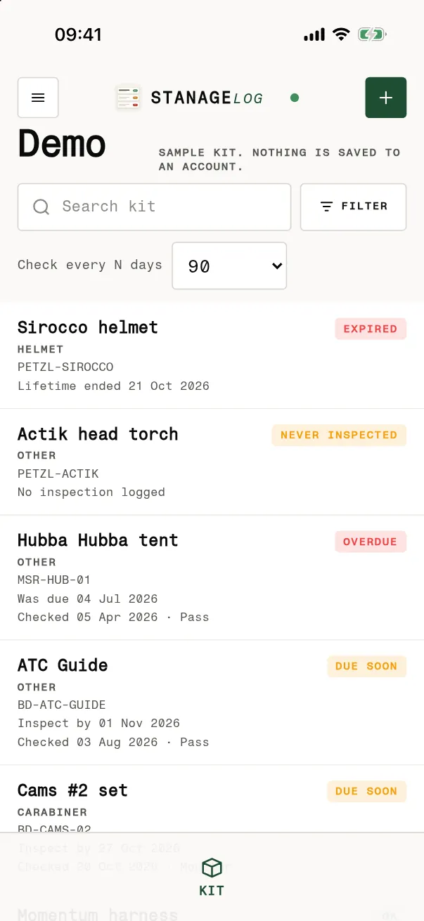
Everything you own, in one list, with what is checked, due soon, or never looked at.

A dated check

Pass, monitor or fail, with the date, so you know before you leave.
More about STANAGELOG
The STANAGELOG kit list on an iPhone, from the sample kit: Sirocco helmet expired, Actik head torch never inspected, Hubba Hubba tent overdue, ATC Guide and Cams #2 set due soon.The STANAGELOG kit list on an iPhone, from the sample kit: Sirocco helmet expired, Actik head torch never inspected, Hubba Hubba tent overdue, ATC Guide and Cams #2 set due soon.
My kit
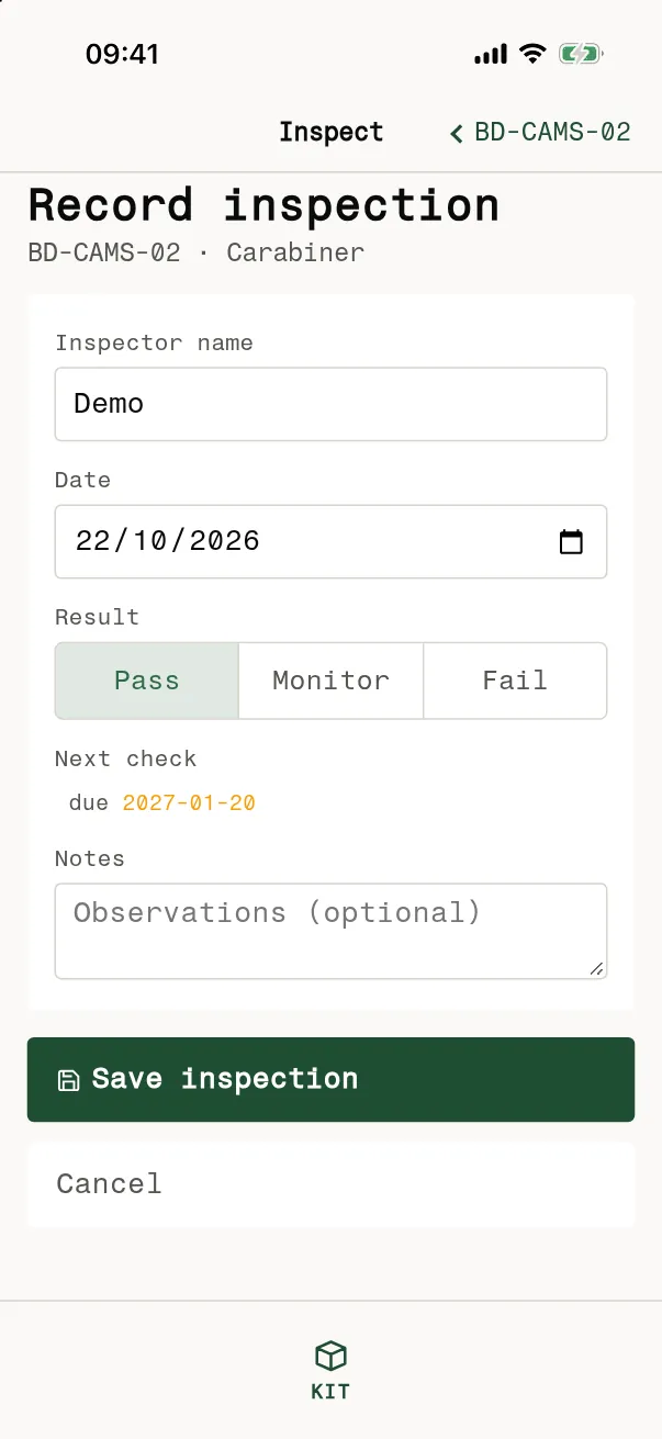
Record inspection screen in STANAGELOG on an iPhone, from the sample kit: inspector name, date, a Pass, Monitor or Fail choice, the next check date and a notes field.Record inspection screen in STANAGELOG on an iPhone, from the sample kit: inspector name, date, a Pass, Monitor or Fail choice, the next check date and a notes field.
Log a check

02 · STANAGEGO

Coming soon

STANAGEGO

Plan the route, and get home safe.

Draw a walking route on open map data with contours, and save the area so the map works with no signal.

Then follow the line. The next turn is always on screen, and the ring shows how long you have left.
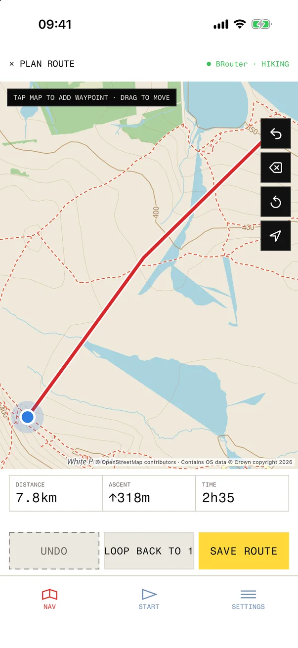
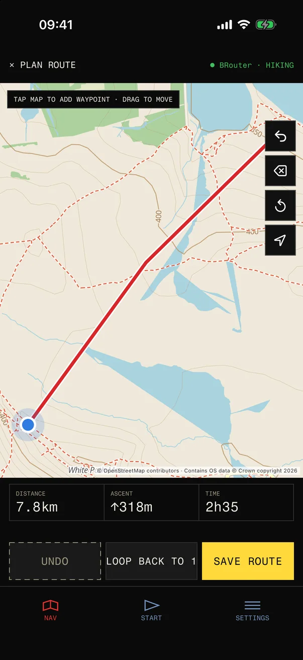
Planning a route in STANAGEGO: tap the map to add waypoints and it draws the route in red over a contour map, with tools to undo, delete and recentre, and the distance, climb and time belowPlanning a route in STANAGEGO: tap the map to add waypoints and it draws the route in red over a contour map, with tools to undo, delete and recentre, and the distance, climb and time below
Plan a route
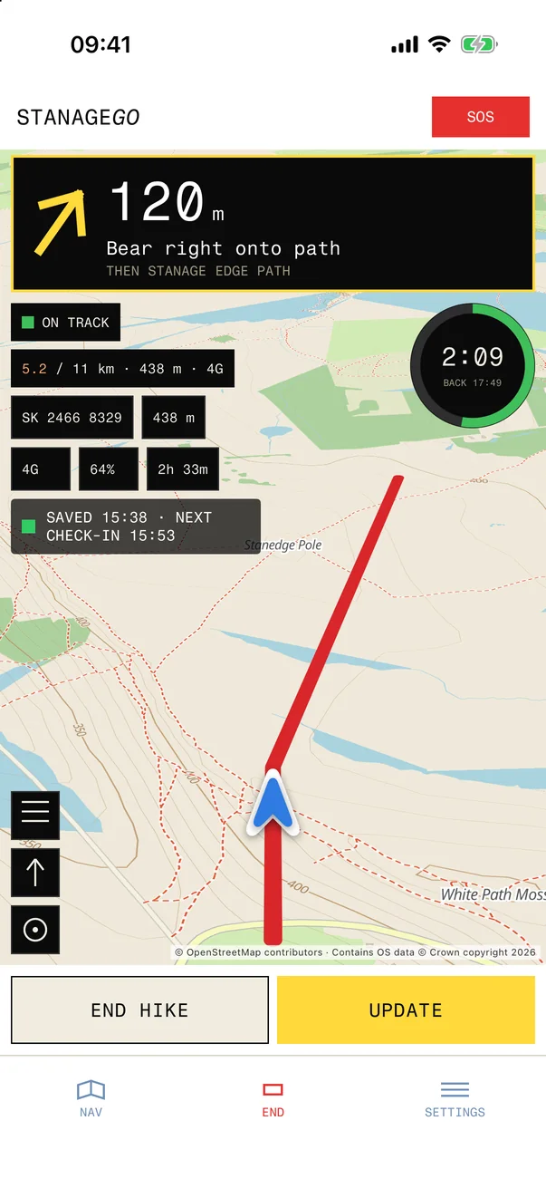
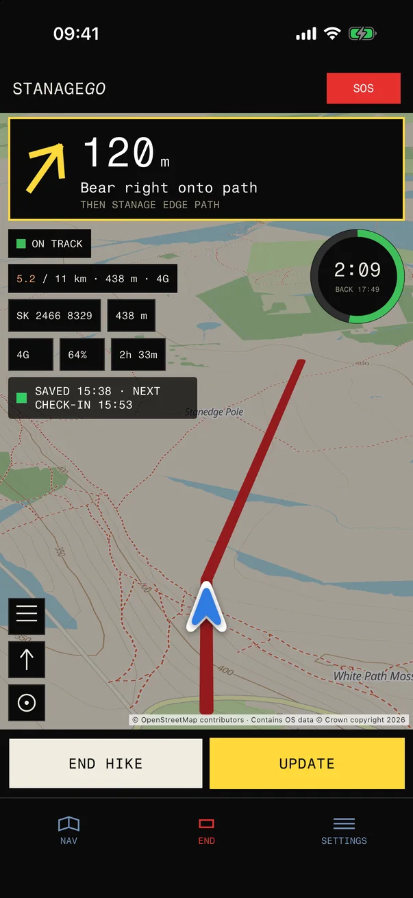
STANAGEGO following a route: the next turn reads 120 m, bear right onto path, then Stanage Edge path, over a map with the route in red, an on-track status, a ring showing 2:09 left and back by 17:49, and END HIKE and UPDATE buttonsSTANAGEGO following a route: the next turn reads 120 m, bear right onto path, then Stanage Edge path, over a map with the route in red, an on-track status, a ring showing 2:09 left and back by 17:49, and END HIKE and UPDATE buttons
Follow it
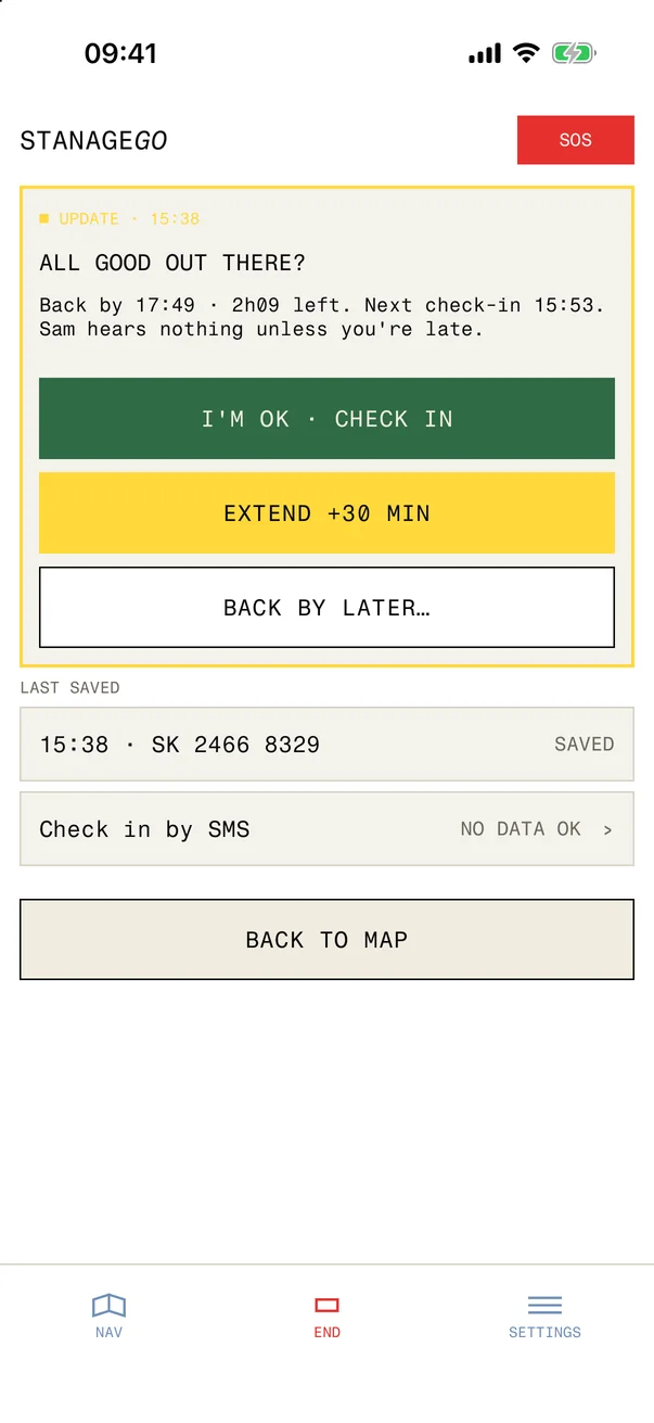
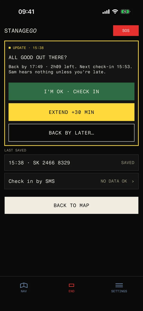
STANAGEGO check-in from the UPDATE button: All good out there? Back by 17:49 with 2h09 left and the next check-in at 15:53, with I'M OK, CHECK IN, EXTEND +30 MIN and BACK BY LATER, the last saved grid reference and check in by SMS when there is no dataSTANAGEGO check-in from the UPDATE button: All good out there? Back by 17:49 with 2h09 left and the next check-in at 15:53, with I'M OK, CHECK IN, EXTEND +30 MIN and BACK BY LATER, the last saved grid reference and check in by SMS when there is no data
Check in
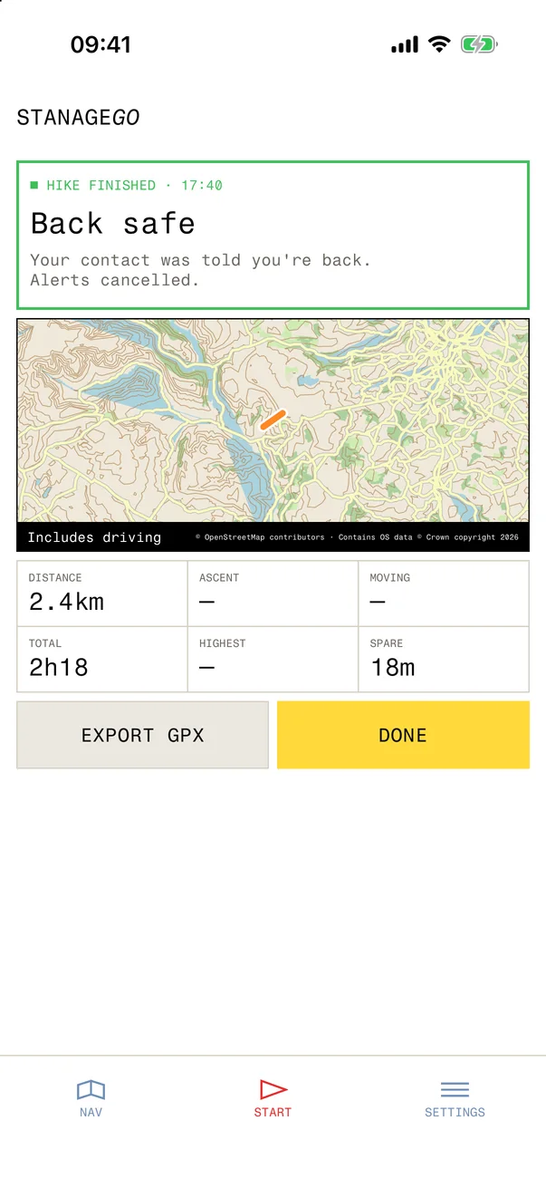
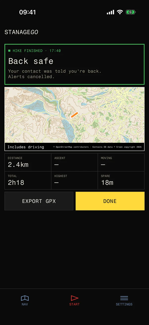
STANAGEGO hike finished: back safe, your contact was told you're back and alerts are cancelled, with a map of the walk, distance 2.4 km, total time 2h18 and 18 minutes to spare, and EXPORT GPX and DONESTANAGEGO hike finished: back safe, your contact was told you're back and alerts are cancelled, with a map of the walk, distance 2.4 km, total time 2h18 and 18 minutes to spare, and EXPORT GPX and DONE
Back safe

Check in on the way, check out at home.

Choose a back-by time and who should know. Check in by app or by text as you go, and end the walk when you are home.

If you are late and do not answer, your contacts get a text with your last location.

Screens from the preview. The app is not out yet.

See the preview